Sapelo Island is the fourth largest of Georgia’s chain of barrier islands. It shares many characteristics with other barrier islands in the southeastern United States, but this one is special. All but 434 acres of the island belong to the State of Georgia and its three major programs: the RJ Reynolds Wildlife Management Area, the Sapelo Island National Estuarine Research Reserve, and the University of Georgia’s Marine Institute (UGAMI). Even more special is the fact that our friend Robbie McNulty is spending the summer working at UGAMI – he’s the reason for this adventure.
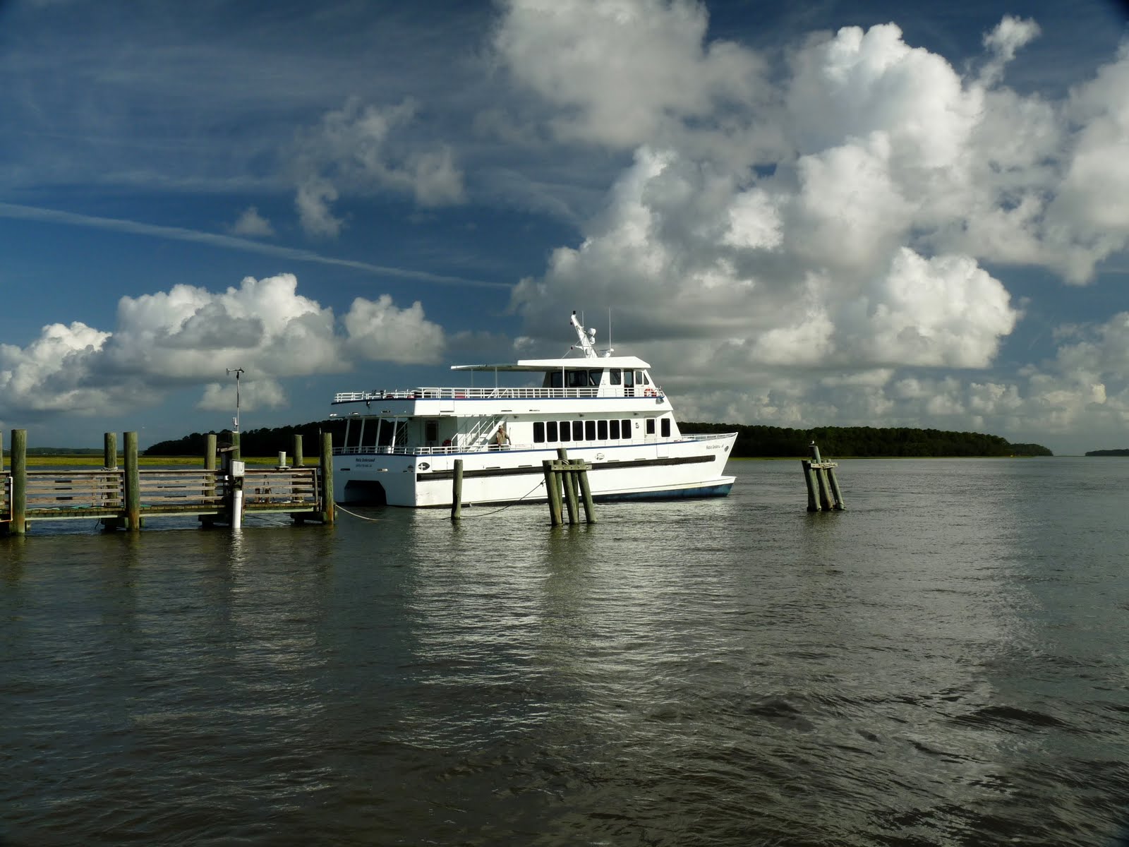
Getting to Sapelo isn’t particularly easy. Casual visitors aren’t allowed – you must be going for a specific purpose and someone on the island must vouch for you. Plus, the only way to get there is by boat – a small passenger ferry makes the trip 3 times a day.
For us, the little town of Darien, GA, was our gateway to Sapelo Island. We drove there one afternoon and spent the night so we could be first in line for the first ferry to the island.
Darien was established in 1736 as a military outpost, and it is recognized as the second-oldest planned city in Georgia. The town is located on a bluff overlooking the Darien River, so we headed to the waterfront for dinner and a walkabout. Skippers’ Fish Camp specializes in fresh local shrimp.
The shrimp-fishing fleet seemed to be in for the evening, but just before the sun set, one fellow loaded up and headed back out to sea. Maybe he’ll bring back enough for breakfast.

Along the waterfront, there were some interesting tabby ruins showing the outline of the original cotton exchange warehouses and naval stores dating about 1815-30. During this period, Darien was an important commercial port for the export of cotton, rice and timber. For inquiring minds: tabby is a building material consisting of lime, sand, water, and crushed oyster shells. It was used as a substitute for bricks, which were rare and expensive because of the absence of local clay.
Other tabby walls were the remains of Fort Darien, which was laid out by General Oglethorpe to protect the town from the Spaniards from Florida. After the war with Spain ended, the fort fell into ruins; it was rebuilt and used again during the Revolution.
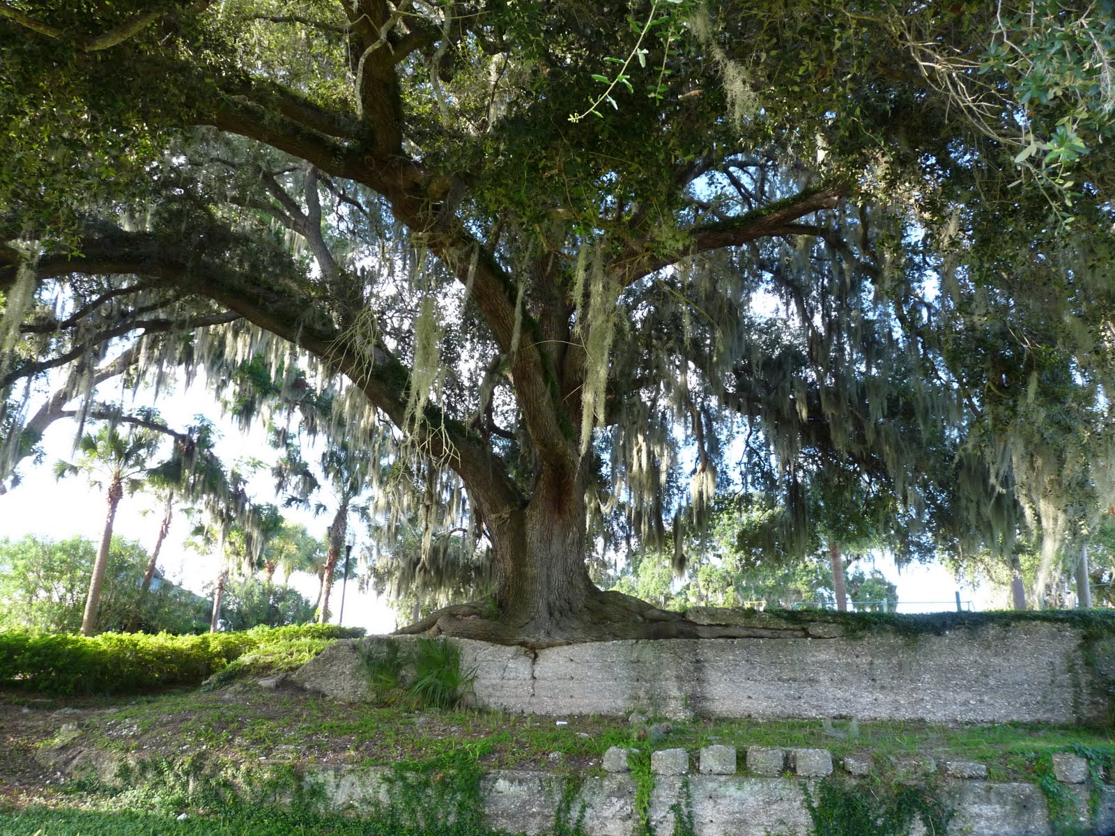
The “Tabby Oak” is a testament to the survival skills of Live Oak trees and to the strength of tabby. This Live Oak grows in and on the tabby walls of the old fort – a unique place in which to thrive.
This is the Adam Strain Building, built in about 1814. It is a stuccoed tabby warehouse that was burned in 1863 and refurbished in 1873. It’s looking pretty sad now, but it was used for many years as a mercantile store and ship’s chandlery. It is the oldest commercial building in Darien.
Finally it was time for the ferry ride out to Sapelo Island. The ferry service, passengers only, is operated by the GA Department of Natural Resources. Going rate for a round-trip ticket is $2.00 – what a deal.
It’s only five miles out to Sapelo, but it’s a winding route through the marshes. From a distance, it looks like green fields forever; up closer, you can see that we travelled through miles of Spartina grass.

Along the way, we passed a lone shrimper. We couldn’t quite figure out what he was doing, except that he sure wasn’t giving out free samples.
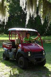
Finally, we made it to Sapelo. We were met by a couple of seagulls and our hosts for the day, Robbie McNulty and his dad, Bob, who was here visiting as well. We traveled mostly by mule – the Kawasaki kind.
Sapelo Island was home to Native Americans 4000 years ago and was the site of a 16th century Franciscan mission. Thomas Spalding was a leading planter of Sea Island cotton and sugar cane during his ownership of Sapelo from 1802 to 1851. Slave descendants still live on the island at Hog Hammock. Sapelo was owned from 1912 to 1934 by automotive pioneer Howard Coffin, followed by tobacco heir R. J. Reynolds from 1934 to 1964. The State of Georgia bought the island from the Reynolds Estate.
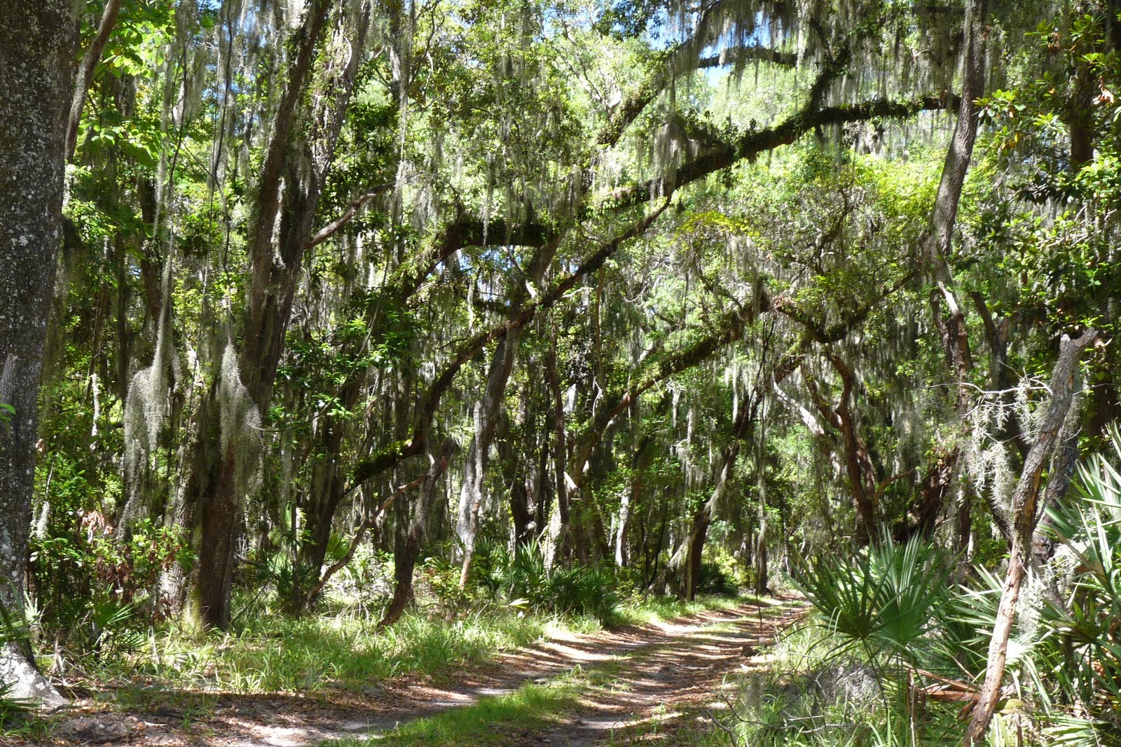
Sapelo Island is about 12 miles long and 3 miles wide. It has beautiful sandy beaches, backed by sand dunes giving way to the maritime forest, and then to the salt marsh. Live oaks, magnolias and pine trees dominate the forest, but there are vast numbers of other plants growing here. Wildlife includes deer, wild pigs, and alligators, as well as many other smaller animals and birds.
The University of Georgia Marine Institute, founded in 1953, is located at the southern end of Sapelo Island. Its two-story research facility was a barn and dairy complex in an earlier era. Today, it’s a modern laboratory, library and workspace, with easy access to the marsh, the sea, or the river.
Nearby is the Reynolds Mansion – named after the last owner even though it was built by Thomas Spalding in 1810, restored by Howard Coffin in 1925, and modernized by RJ Reynolds during his ownership. Here Bob and Margaret share a laugh, while Robbie visits with a friend in the swimming pool.

This is a fine place for walking around – admiring the live oaks draped with Spanish moss. The ocean isn’t far away, so there’s just enough breeze to offset the misery of summertime weather in the South. Robbie gave us a grand tour of the area; we were joined by his friend Danielle, another student working here for the summer.
If you’re walking with Robbie, you’re always on the lookout for alligators. He’s working on a project that involves catching these critters, tagging them and monitoring them over time. So – happy day – here’s a gator just for us – all 3 ½ feet of him! We tried to help Robbie catch this monster, but we weren’t much help and the gator wasn’t much interested.


For lunch, we went to Hog Hammock, or as the scientists call it, “The Community.” Hog Hammock is the island’s privately owned community. Most of its 70 residents can trace their Sapelo ancestry back to the early 1800’s – they are descendants of former slaves and tenant farmers employed by the island’s plantation owners. We joined the crowd at Lula’s Kitchen and enjoyed some fine eating – ribs, chicken, fish, sweet potatoes, squash, green beans, homemade biscuits, and more. Nobody left there hungry.
With full bellies, we set off to see the rest of the island. James (the resident alligator expert) and Danielle joined us for the afternoon adventure. We headed north and east to Cabretta Beach – just across this one-lane bridge. The DNR maintains a campsite here; it’s mostly used by scouts and other groups.
At the north end of the island, Blackbeard Creek provides the boundary between Sapelo and Blackbeard Island – all of Blackbeard Island is a national wildlife refuge. This is known as Raccoon Bluff and it’s a favorite swimming hole for folks from the Marine Institute.
Nearby is the First African Baptist Church at Raccoon Bluff, dating to 1866. After Thomas Spalding’s 400+ slaves were freed, they established several settlements scattered around Island. Raccoon Bluff was one; others included Shell Hammock, Belle Marsh, Lumber Landing, and Hog Hammock. When RJ Reynolds ruled the island, he forced all island residents into the one community at Hog Hammock. The church at Raccoon Bluff is now used only for special events.
From Raccoon Bluff, we headed west toward the marsh. The road is rough, but the scenery is pure low country – live oaks, pine trees, Spanish moss, scrub palmetto. We were making far too much noise to see any wildlife, but deer and hog tracks and alligator slides were abundant.
On the western side of the island, we stopped to visit what’s left of Chocolate Plantation. This area of Sapelo was once a prosperous Sea Island cotton plantation. The tract was occupied by French royalist from 1789-1795, then sold to Edward Swarbeck, who built a large plantation house and a number of slave cabins.


The tabby barn overlooking the Mud River was built in 1830. Another visitor was enjoying the wildflowers growing nearby.
Back on the road, there was a slight obstacle to travel - a tree across the road. Fortunately, we were traveling with guys prepared for anything - James and Robbie used the truck to drag the log out of the way and off we went again.
Further north is an ancient shell ring – perhaps the oldest man-made structures in the state of Georgia. This is a doughnut-shaped mound built from layers of different types of shells, including oyster, clam, conch and mussel. The ring rises approximately 25 feet above the tidal marsh and has a diameter of 255 feet. The site has been radiocarbon dated 2170 B.C., making it older than Egypt’s pyramids.
Research suggests that shell rings are unintentional monuments built up over many years as Native Americans discarded their trash. Thus, the shape of the rings is the result of Native Americans living in circular villages and discarding their trash behind their homes. (In the left photo below, I am standing on top of the ring; the right photo below is the view across the diameter of the ring.)

In fact, the shell rings don’t just contain shells, but also the bones of fish, reptiles, and mammals. Today, the rings are covered with 4,000 years worth of dirt and debris, but they offer an intriguing look at the work of ancient architects of a lost world.
Finally, it was time to head back to civilization – again, through magnificent maritime forest.
We went back to ‘gator headquarters – the summer home of Robbie and his mentor, James, the alligator researcher. Cold drinks and a quick snack were much appreciated, as was the air-conditioning. We said our goodbyes and were on our way. We’ll have fond memories of this day – great to see Robbie in his element, a bonus to see Bob at the same time, and a wonderful visit to a very special place.